Things to do along the Sea to Sky Highway
Given that British Columbia is a world class travel destination, we intentionally spent the summer exploring locations close to our home in Vancouver. Today, we’d like to share our favourite things to do along the Sea to Sky Highway.
There’s good reason why it’s consistently rated as one of the best scenic drives in Canada.
The Sea to Sky Highway, also known as Highway 99, is a beautiful mountain drive that begins in Vancouver and continues to Pemberton, passing through Squamish and Whistler along the way.
Now, some might argue that the highway actually begins at the USA border in South Surrey and ends at Cache Creek. They would not be wrong. However, for the purposes of this blog post, we will focus on the Sea to Sky Corridor, which starts in West Vancouver and ends in the Pemberton Valley.
Skip ahead using the Table of Contents
Top places to stop in the Sea to Sky Corridor
As residents of Vancouver, we sometimes forget we how lucky we are to live in such a beautiful part of the world.
Every time we return from an international trip we’re reminded that we need to spend more time exploring British Columbia. You can visit most of these Sea to Sky attractions year round; however, the focus for this blog post will be summer activities.
There are so many awesome things to do along the Sea to Sky Highway that you can’t possible do them all on one trip. That said, if you do prove us wrong, please let us know because that would be an epic road trip for the history books!
You might also like – 25 Awesome Day Trips from Vancouver
Cypress Provincial Park
The Sea to Sky Corridor begins in West Vancouver, so let’s start here.
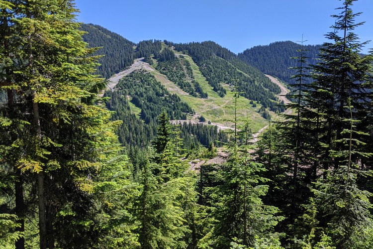
Cypress Provincial Park is home to Cypress Mountain, a popular ski area in West Vancouver. It actually hosted events at the Vancouver 2010 Winter Olympics. During the summer, Cypress Provincial Park offers a variety of hiking trails for all skill levels. More info about summer trails here.
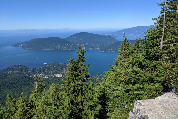
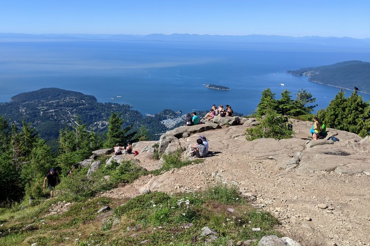
One of our favourite hikes is the Eagle Bluffs and Black Mountain trail. The trail starts with a steep leg burner that begins at the parking lot at the base of Cypress Mountain. You hike straight up a series of switchbacks beside the downhill ski runs. The trail continues past a few mountain lakes and tall forest before reaching the outstanding views of the Lower Mainland and Georgia Straight from Eagle Bluffs (see the above and below photos).
The Eagle Bluffs hike is approx. 9 km round trip with a 350 meter elevation gain. It takes about 4 hours to complete, including a 15 minute break at the viewpoint.
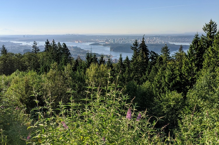
If hiking is not your thing, it’s still worth driving up the mountain to visit the Cypress Mountain Viewpoint. This is one of the best locations to witness panoramic views of Vancouver and the Lower Mainland. On a clear day, you can see the towering Mount Baker in Washington State.
Related – The Best 10 Day Road Trip from Vancouver
Views of Georgia Straight from Eagle Bluffs trail in Cypress Provincial Park.
Summer hiking trails on Cypress Mountain in West Vancouver.
The best view of Vancouver from the Cypress Mountain lookout.
Horseshoe Bay
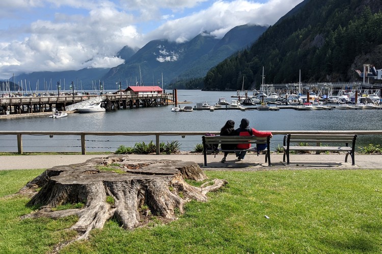
Horseshoe Bay is the gateway to Howe Sound and the Sunshine Coast.
It’s located on the western tip of West Vancouver and is often considered the starting point for the Sea to Sky Highway, assuming your driving north from Vancouver.
Horseshoe Bay is also the location of the third busiest BC Ferries terminal. If you plan to visit Vancouver Island, Bowen Island or the Sunshine Coast, you will board the ferry at Horseshoe Bay. Because of this, many people overlook Horseshoe Bay as a destination on its own.
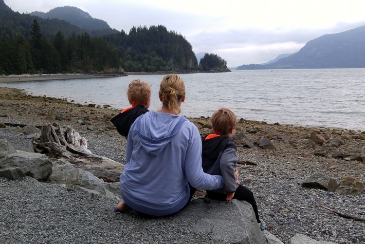
Horseshoe Bay is a fun place to have lunch and spend a couple of hours. There are a few restaurants in the village, including the popular Trolls Restaurant (get the Oyster Burger with Clam Chowder). It has a rocky beach with a playground, making it an ideal spot for families.
Related – The best 10 day road trip from Vancouver
Whytecliff Park in West Vancouver
While you’re in the neighbourhood, we recommend you visit nearby Whytecliff Park, one of the first Marine Protected Areas in Canada. Whytecliff is not very big, so it’s easy to explore the entire beach park and trails in about an hour or two.
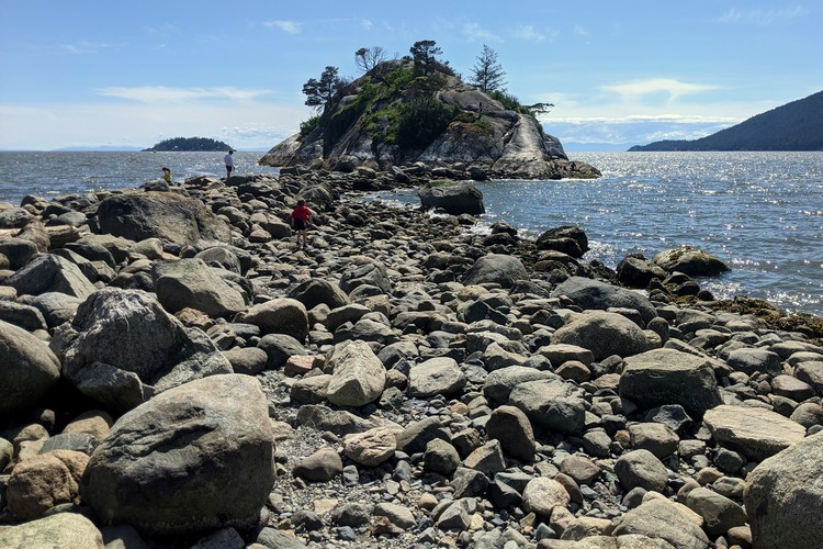
At low tide you can walk across the big rocks to Whyte Islet, pictured below.
Low tide reveals the rocky path to Whyte Islet from Whytecliff Beach Park.
The beach at Whytecliff Park in West Vancouver.
Boat ride around Howe Sound
Howe Sound is surrounded by a network of fjords situated between West Vancouver and the Sunshine Coast. It is the body of water that makes up the ‘SEA’ part of ‘Sea-to-Sky’.
Driving a small speed boat around Howe Sound is a unique way to experience the natural beauty of British Columbia’s south coast. During the summer, you can visit the lazy sea lions that hang out on Pam Rocks. The only way to see visit these rock islands is by boat.
The best place to rent boats is Sewell’s Marina, located in Horseshoe Bay. Renting a boat is relatively inexpensive and you do not need a special boat licence. A standard driver’s license is sufficient. For two hours of personal boat time (usually enough to get to the seal colony and back) it’s about $180 (check rates here). The boats take between 4 to 6 people.
To visit these marine parks and secluded coves that can only be reached by water, it’s best to do the 4-hour rate. If you do, head to Gambier Island or Anvil Island.
Don’t forget your swim shorts if the weather is nice.
Porteau Cove Provincial Park
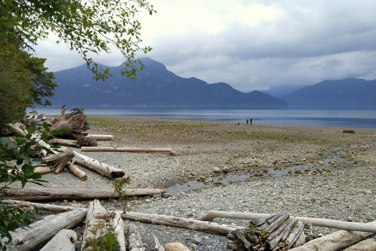
Porteau Cove is a small provincial park in British Columbia (about 50 hectares in size), situated on the most southerly fjord in North America. The park stretches between the shore of Howe Sound and the Sea to Sky Highway. It’s located 20 minutes south of Squamish.
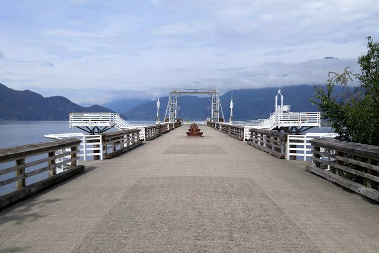
Aside from its rocky beaches and breathtaking mountain views, Porteau Cove’s star attraction the old ferry terminal that’s been converted into a pedestrian pier.
Porteau Cove also a popular spot for cold water scuba diving because it has a series of artificial reefs and two sunken ships.
Keep an eye out for the road signs as you approach Porteau Cove while driving north on the Sea to Sky Highway. You will be turning left at the turnoff, so stay in the left lane and watch your speed so you don’t miss the turnoff.
Porteau Cove Olympic Legacy Cabins
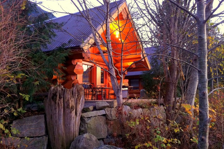
If you’re looking for a unique place to stay along the Sea to Sky Highway, check out the Porteau Cove Olympic Legacy Cabins.
These beautiful log cabins got their name because they were initially built for the 2010 Winter Olympics and later relocated to Porteau Cove Provincial Park. The log cabins are a work of art, complete with hand-carvings of bears and beavers.
We’ve stayed at these oceanfront cabins four times over the past five years. Read about our first experience and see photos of the Olympic Legacy Cabins here.
You must make reservations for the Porteau Cove Olympic Legacy Cabins well in advance because there are only two cabins. If you’re the type who likes to make last minute reservations, you will be disappointed because these cabins book up fast. You might have to make reservations up to one year in advance to get a holiday weekend.
Check availability and pricing here.
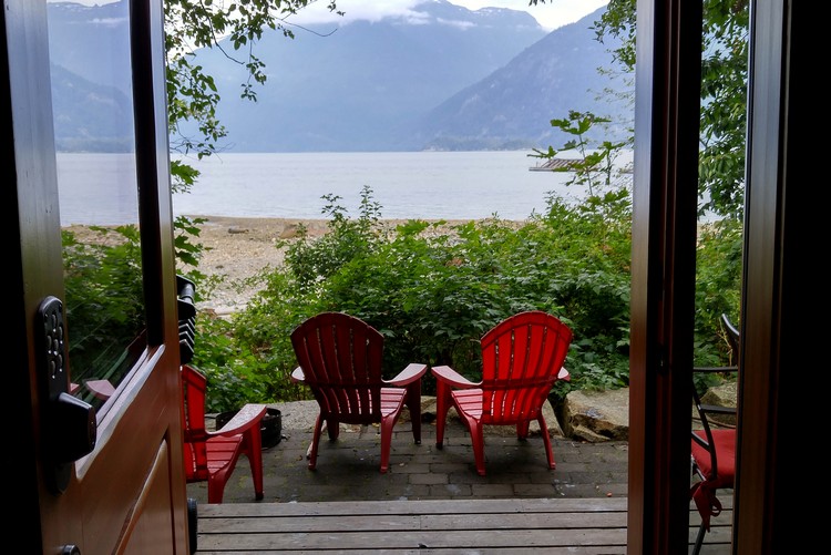
Oceanfront views from the Porteau Cove Olympic Legacy Cabins.
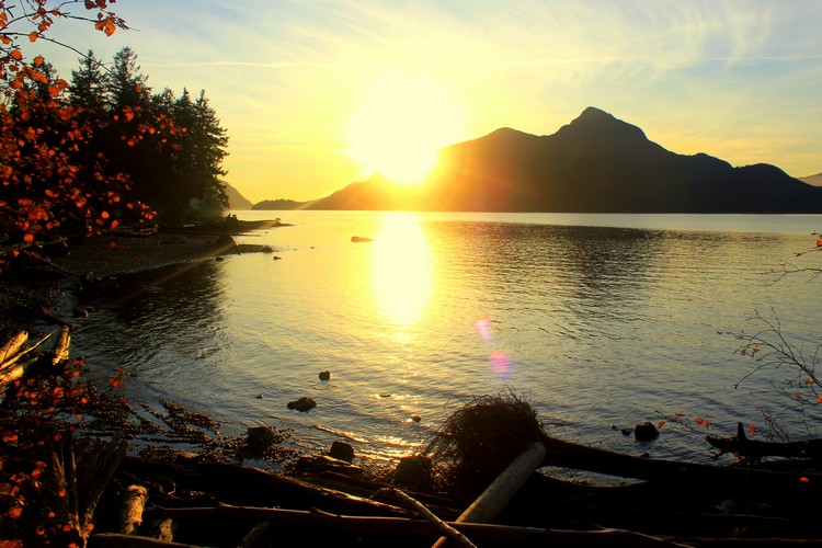
If you can time it properly, try to visit at sunset. The west facing views are incredible.
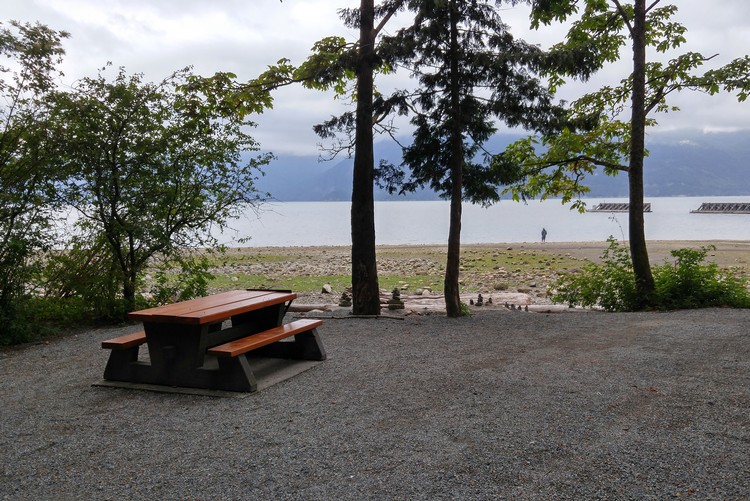
Enjoying the moment. The beach at the Porteau Cove Provincial Park campground.
The landmark pier at Porteau Cove Provincial Park in British Columbia.
Britannia Mine Museum
The Britannia Mine Museum is one of the most unique things to do along the Sea to Sky Highway.
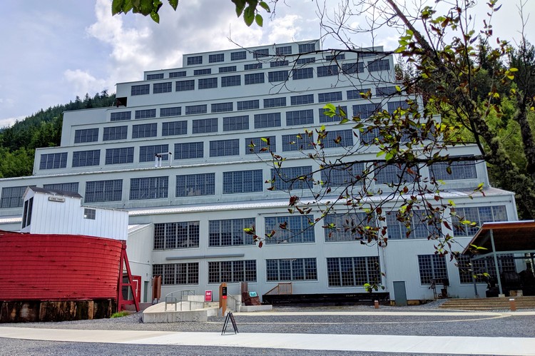
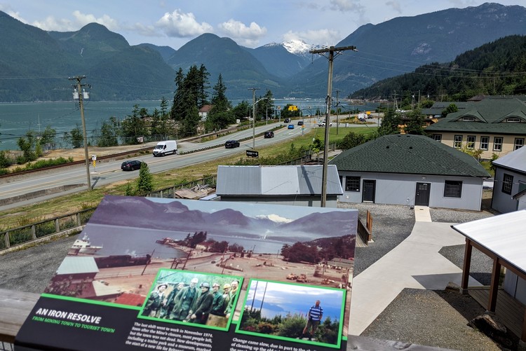
The Britannia Mine Museum is both a National Historic Site and British Columbia Historic Landmark. It has a fascinating history that dates back to 1904, when it was the largest copper mine in the British Empire.
There are over 210 km’s of mining tunnels in the mountains surrounding Britannia Beach. Think about that for a moment.
We learned that over 60,000 people from 50 countries once lived and worked in this old mining community over the course of its life from 1904 to 1974.
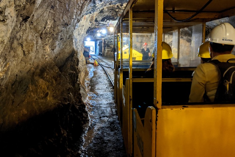
We visited the museum a few years ago, but our boys were still quite young and they didn’t remember the museum. So, given that we’re advised to travel close to home this summer, we thought it would be a fun day trip from Vancouver. Our boys had a great time exploring the underground mine tunnel on the train ride. And, of course, they loved searching for gold and treasures in the gold panning exhibit.
Ticket prices and reservations here. Guests are asked to arrive 15 minutes prior to reservation time. The underground tour is included with admission. Plan to spend 2 hours at the museum.
If you like this attraction, you also like the train museum in Squamish.
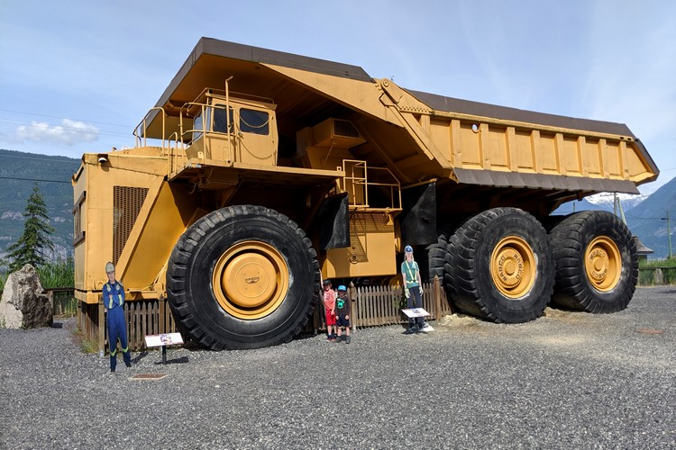
The iconic big yellow dump truck at Britannia Mine Museum. If you’ve driven the Sea to Sky Highway, you’ve likely seen this monster truck as you pass through Britannia Beach.
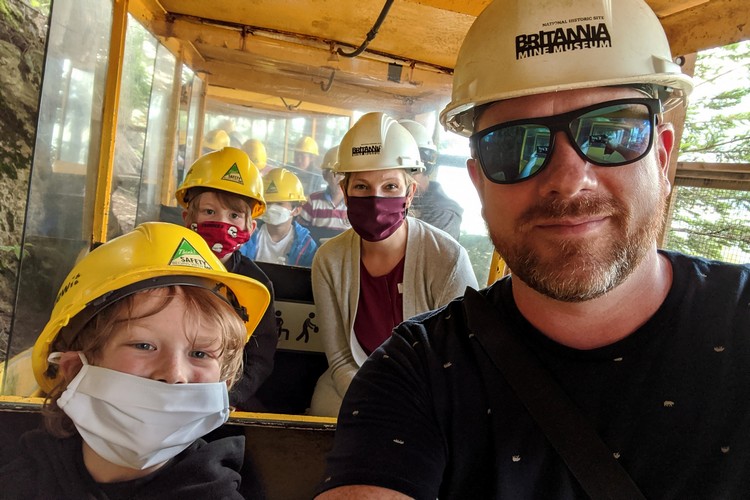
Family selfie on the old train that transports guests through the old mine tunnels.
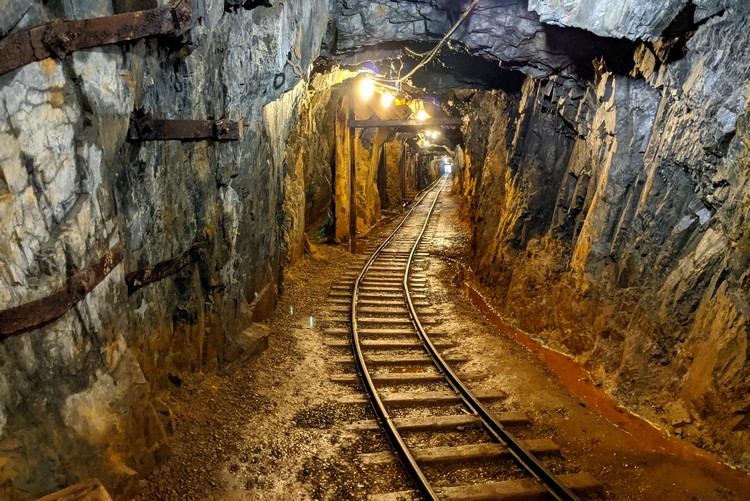
Rail track inside the old mine tunnel at Britannia Mine Museum.
Inside the historical Mill 3 to watch BOOM!, the newest attraction at Britannia Mine Museum. It’s a fun way to watch the old mill come back to life.
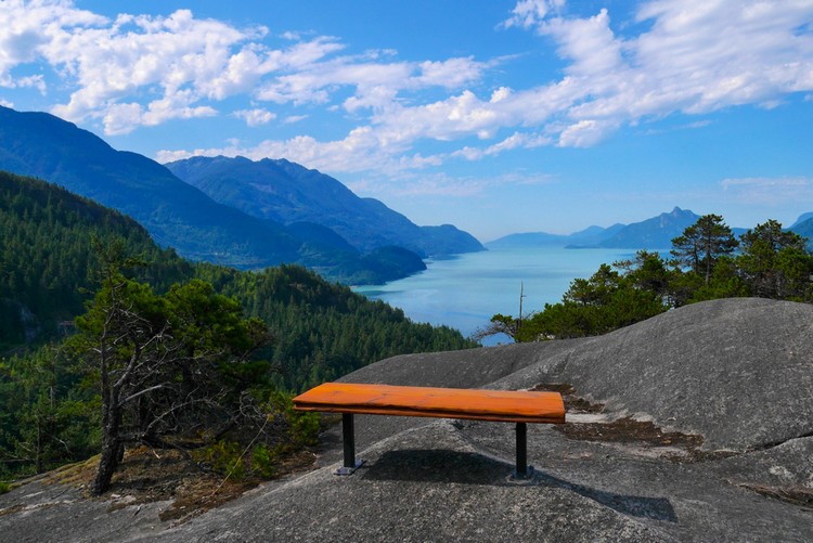
Murrin Provincial Park
Shortly after you pass Britannia Mine Museum, you will approach Murrin Provincial Park (assuming you are driving from Vancouver to Squamish). The turnoff comes up quickly, so you’ll want to reduce your speed and look for a flashing yellow light. You will be turning left.
This little park gets busy on summer weekends because of Browning Lake, which is a very popular swimming lake for weekend crowds. Parking is limited, so you’ll either need to arrive early or pack your patience as you wait in the parking lot for other visitors to leave.
The Murrin Park Loop Trail is a popular hike in the Sea to Sky Corridor. It’s a 2 km loop with an elevation gain of 150 meters. This intermediate hiking trail leads to a viewpoint that offers spectacular views of Howe Sound. The hike takes about 1.5 hours to complete.
Hikers can also access the Petgill Lake trail from the parking lot at Murrin Provincial Park. This 11.5 km hike has an elevation gain of 650 meters and takes about 6 hours to complete. It’s a lesser known hiking trail in the Sea to Sky Corridor, so you’ll find less crowds here.
Related – The Best Road Trip that departs and finishes in Vancouver
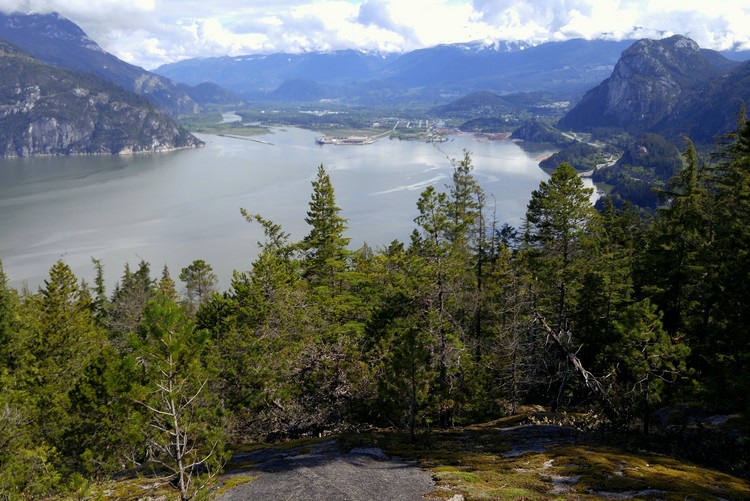
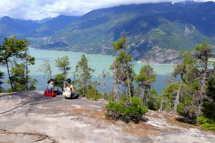
Views of Howe Sound and Squamish from Petgill Lake trail. Notice the Stawamus Chief located in the top right corner of the above photo.
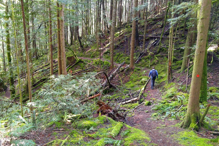
Hiking in the temperate rain forest along the Sea to Sky Highway.
Shannon Falls Provincial Park
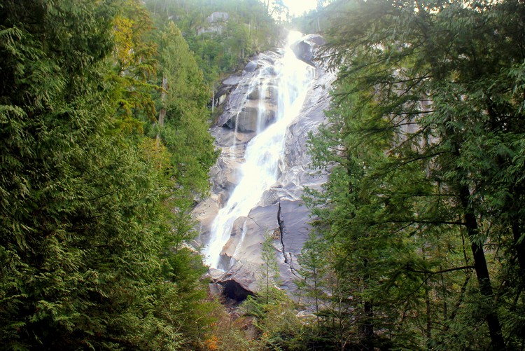
Located right beside the Sea to Sky Highway, Shannon Falls Provincial Park is home to the 3rd highest waterfall in British Columbia.
At 335 metres, Shannon Falls is a must visit attraction in the Sea to Sky Corridor. It’s a short 5 minute walk from the parking lot to the base of the waterfalls. The trail is flat with little elevation, so it’s an easy walk to reach the falls.
If you’re looking for a good half-day hike, try the Upper Shannon Falls trail. The trail can also be accessed from the from the Stawamus Chief parking lot. This hike is 7 km and takes about 5 hours to complete. It’s a leg burner that will surely get your heart rate moving.
There are two waterfall viewing platforms, so make sure you visit both to get a different perspective of the waterfall. The waterfall is most impressive during the spring and early summer, when the mountain snow melts and water flow is at its highest. The powerful waters of Shannon Falls originate from Mount Habrich and Mount Sky Pilot.
Parking can be challenging during the summer months, especially on weekends. There is an overflow parking lot on the opposite side of Highway 99 (the Sea to Sky Highway).
Because the waterfalls are easy to access and it doesn’t take long to view them, people come and go frequently. You only need 30 minutes to visit Shannon Falls. Waiting for a parking spot to come free can be frustrating, but parking spots do open if you’re patient.
More info about Shannon Falls Provincial Park here.
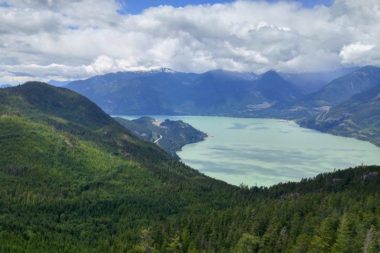
Views of Howe Sound from the Upper Shannon Falls trail.
The Upper Shannon Falls hike continues to the Sea to Sky Summit trail. This means you can take the Sea to Sky Gondola back down to the parking lot. Then you walk the short connector trail back to Shannon Falls parking lot.
Stawamus Chief Provincial Park
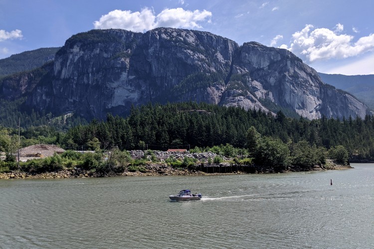
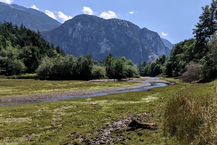
Located along the Sea to Sky Highway, the Stawamus Chief is one of the largest granite monoliths in the world.
The Stawamus Chief Provincial Park protects the massive 700 metre granite cliffs that tower over the town of Squamish. It’s widely known as one of the best rock climbing spots in Canada.
The Chief is one of the most popular hiking trails along the Sea to Sky Corridor. You access the hiking trails a from the day-use parking lot located on the Sea to Sky Highway. The trails are also accessible from Shannon Falls Provincial Park via the 1.5 km connector trail.
There are three hikes on “The Chief”
- First Peak – 1.5 km trail with an elevation gain of 540 metres
- Second Peak – 1.7 km trail with an elevation gain of 590 metres
- Third Peak – 1.8 km trail with an elevation gain of 630 metres
The above distances are one way. You must also consider your return hike back down. Plan for about 3 to 4 hours to do the Chief. It’s a strenuous hike for many, so bring plenty of water and snacks, wear proper footwear and check the weather conditions prior to your hike.
See the Stawamus Chief trail map here.
Sea to Sky Gondola
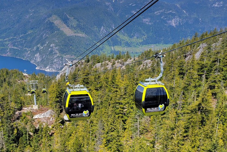
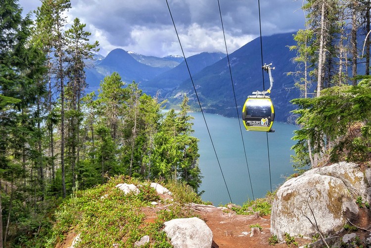
The Sea to Sky Gondola has become one of the most popular things to do along the Sea to Sky Highway.
We visited this Squamish attraction shortly after it opened in 2014 (read about our experience here). The Sea to Sky Gondola transports passengers from the parking lot, located directly beside the Sea to Sky Highway, up the side of steep granite cliffs to the Summit Lodge.
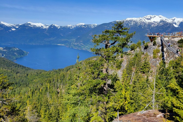
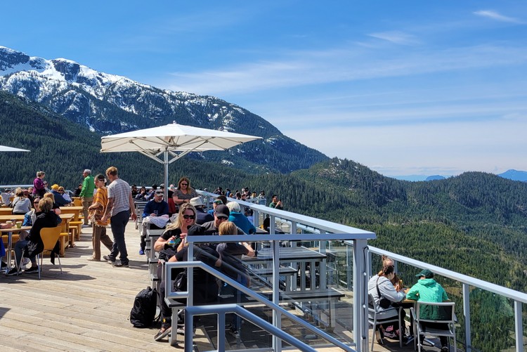
Once you reach the top, you have access to the Summit Lodge Viewing Deck, Sky Pilot Suspension Bridge, several hiking trails and two interpretive loop walking trails with viewing platforms.
The Summit Lodge Viewing Deck offers outstanding views of the blue-green waters of Howe Sound and the lush Squamish Valley. The Chief Overlook Viewing Platform is accessed from the middle of the Panorama Trail and is 800 metres from the Summit Lodge (about a 15 minute walk).
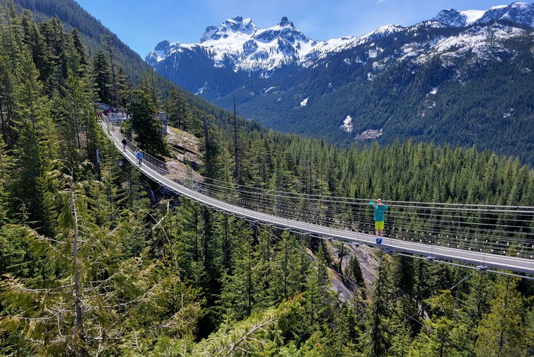
Sky Pilot Suspension Bridge
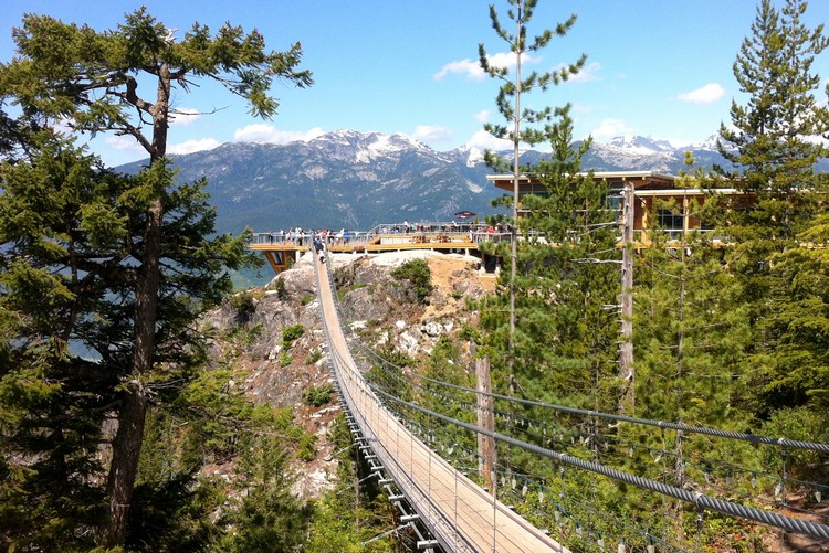
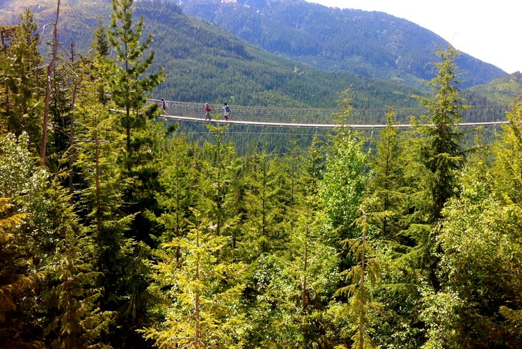
The dizzying Sky Pilot Suspension Bridge connects the Spirit Trail/Spirit Viewing Platform to the Summit Lodge Viewing Deck. The bridge is approximately 100 metres long and is a must do for anyone visiting the Sea to Sky Gondola.
Should you visit the Sea to Sky Gondola? Read about our experience here.
The Sky Pilot Suspension Bridge and Summit Lodge viewing deck.
Hiking at the Sea to Sky Gondola
Hikers can reach the summit by tackling the challenging Sea To Summit Trail. This leg-burning 7.5 km trail climbs over 900 metres of elevation and takes about 3.5 hours at a moderate pace. Once you reach the Summit Lodge you can take the gondola back down to the parking lot.
Here’s more info about the Sea to Sky Gondola hiking trails. Check out the Sea to Sky Gondola trail map to get a better understanding of the trails. You can also download the trail map app here.
Sea to Sky Gondola parking is free. However, if you plan to visit on a summer weekend, it’s best to arrive early because parking is limited and it gets busy.
Related post – 15 Things to do in Squamish in the summer
View of the Sea to Sky Gondola from the Sea To Summit Trail.
The spectacular mountain views from the observation deck at the Summit Lodge. Watch this short video from our most recent visit.
Squamish Adventure Centre
Squamish is the self-proclaimed ‘Adventure capital of Canada’ and it’s a great place to stop while exploring the Sea to Sky Corridor. We could easily dedicate an entire blog post about things to do in Squamish.
You can make several day trips from Vancouver to Squamish and still only scratch the surface.
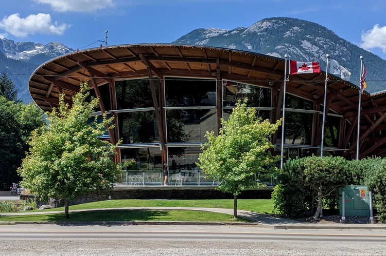
Visit the Squamish Adventure Centre to learn about what to see and do in Squamish. The facility is located on the Sea to Sky highway, just north of the main intersection that leads to downtown Squamish.
If you prefer to get in the water, the Squamish Spit hosts some of the best windsurfing and kite surfing in the Pacific Northwest. There area also dozens of hiking trails and parks, including the family-friendly Four Lakes Trail in Alice Lake Provincial Park, Smoke Bluffs Park loop trail, or the full day Elfin Lakes hike.
For a leisure walk, check out Rose Park near the Squamish Adventure Centre.
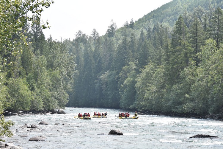
Elaho-Squamish and Cheakamus Rivers offer river rafting in Squamish and Whistler.
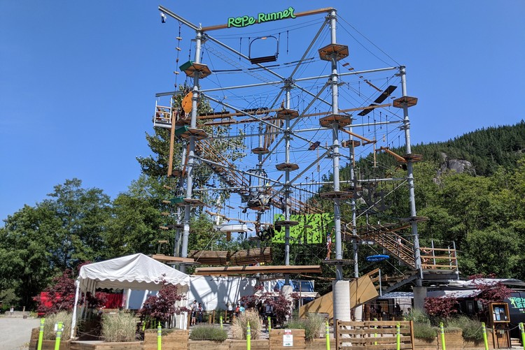
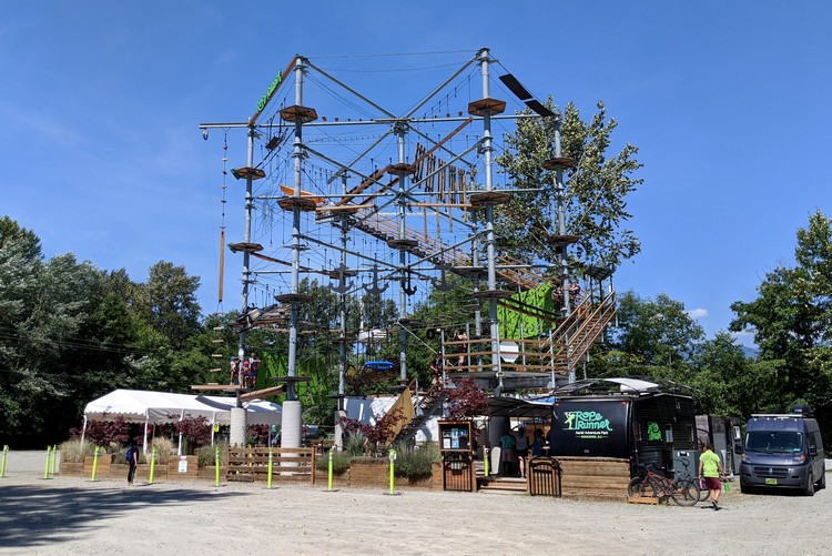
Rope Runner Aerial Adventure Park
The Rope Runner Aerial Adventure Park is a new attraction in Squamish. It’s located across the street from the Squamish Adventure Centre, just off the Sea to Sky Highway. Get directions here.
The outdoor aerial adventure course features 50 elements of varying difficulties with no set course, so guests can explore at their own pace and comfort level. They use the CLiC-iT Safety System that ensures guests are continuously attached to the safety cable at all times.
Sessions run every 30 minutes from 10:00 AM. The last session starts at 4:30 PM.
Book online to save $5 on admission. Check ticket pricing and passes here.
Downtown Squamish
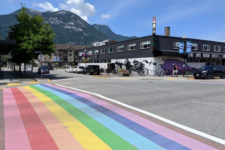
While there is an abundance of outdoor adventures to be had on the Sea to Sky Corridor, downtown Squamish should also be added to your list of things to do along the Sea to Sky Highway. The downtown area is 5 minutes from the main Squamish intersection on the Sea to Sky Highway.
The main street in downtown Squamish is Cleveland Avenue. Here you will find coffee shops, boutique retail stores, native art stores, restaurants, the Squamish Public Library, Junction Park & O’Siyam Pavilion and Howe Sound Brewery at the far end.
The Squamish Farmers’ Market is a popular attraction with over 60 vendors selling a variety of local produce, cheese and artisan goods. It’s open on Saturdays from 10:00 AM to 3:00 PM. The market is a great place to pick up items for a picnic that can be enjoyed at one of the parks in Squamish.
Other Squamish activities include a visit the West Coast Rail Heritage Park, paddling and fishing on Alice Lake, white-water river rafting down the Elaho-Squamish and Cheakamus River, watch Kiteboarders at the Spit, and join a brewery tour at Howe Sound Brewing.
Restaurants in Squamish
Downtown Squamish has several restaurants, so it’s an ideal place to stop for lunch. Popular Squamish restaurants are The Salted Vine, The Copper Coil, Zephyr Cafe, Fergies Cafe and Howe Sound Brew Pub.
You will find most fast food restaurants in Squamish, easily accessed from the Sea to Sky Highway. If you’re looking for a quick bite, there are drive through pick-up windows at the McDonalds, Tim Hortons and A&W. Squamish also has a White Spot, Boston Pizza and Pizza Hut, if you’re looking for a family restaurant.
Related post – 15 Things to do in Squamish in the summer
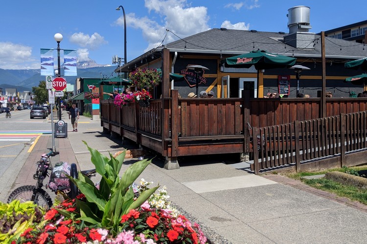
Tthe outside patio at The Copper Coil in Downtown Squamish.
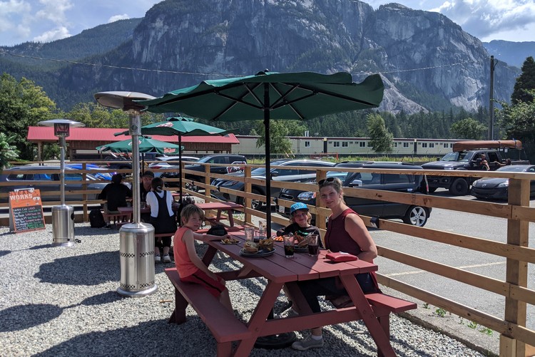
Family lunch at The Copper Coil with The Chief in the backdrop.
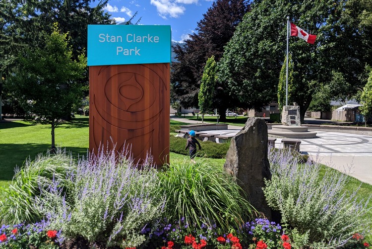
Stan Clarke Park in Downtown Squamish has a playground for kids.
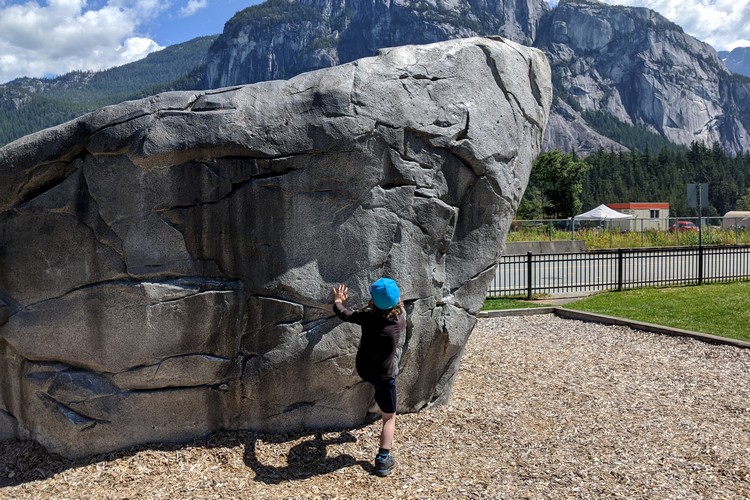
Kids rock climbing wall at Junction Park in downtown Squamish. The Stawamus Chief in the backdrop.
Brackendale Eagle Viewing
Squamish is home to one of North America’s largest congregations of bald eagles.
It’s said have more eagles than anywhere else in the world, seeing over 1,300 eagles each year. It is estimated that 70% of bald eagles are found in British Columbia and Alaska [source].
Brackendale Eagles Provincial Park, which was established to protect the bald eagle habitat, is a great spot for eagle watching in Squamish. The provincial park is located on the west side of the Squamish River, near the community of Brackendale. There are no river crossings, so you will view the park and its famous birds from the east side of the river.
Many eagles migrate to Squamish in the fall to feed on spawning salmon. Peak eagle-viewing is from November to February, although you will likely see eagles in this area throughout the year.
The EagleWatch Interpretive Program, a volunteer-run community initiative, help visitors view eagles with high-power telescopes. Interpreters share information about the birds and the importance of viewing the birds from a distance, without disturbing their natural habitat.
Mamquam River Trails
You can also walk the Mamquam River Trails to view the coho and steelhead salmon spawning in the Mamquam River Salmon Spawning Channels. There are over 4 km of easy walking trails in this area, which is ideal for families with younger kids.
Brohm Lake Interpretive Forest
Brohm Lake Interpretive Forest is located just north of Squamish, on the west side of the Sea to Sky Highway.
We’ve passed it countless times on our way from Vancouver to Whistler and each time we pass by we say, “one of these days we should check out Brohm Lake”. A few weeks ago, we finally decided to pull over and check it out.
Like most stops along the Sea to Sky Highway, the parking lot was full at the Brohm Lake Recreational Site. It was a nice Sunday afternoon in the summer, so this is to be expected. It was about a 20 minute wait until a car left and a parking space became free.
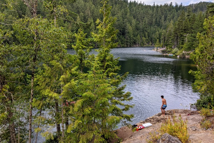
The lake is much bigger than we expected. We assumed it was similar to Browning Lake in Murrin Provincial Park, but we would guesstimate it’s about 5 times the size.
Hiking at Brohm Lake in Squamish
There are a few hiking trails that can be accessed from the parking lot at Brohm Lake Recreational Site.
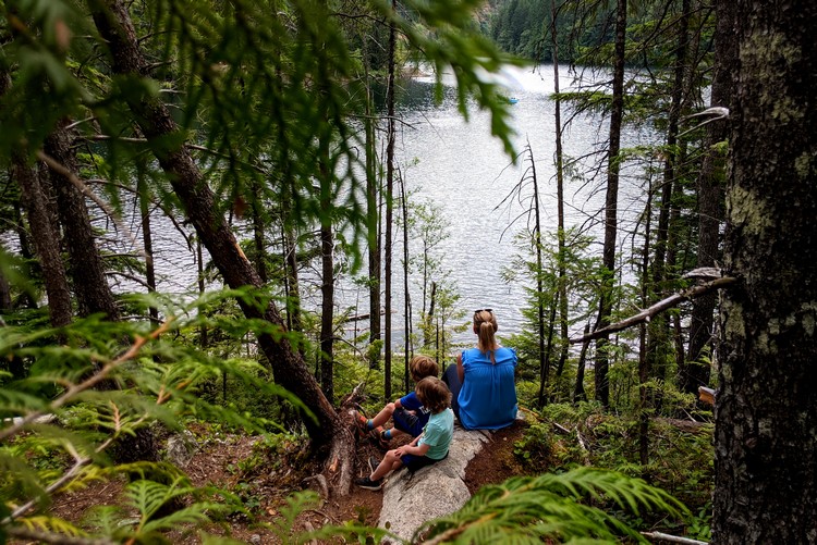
We decided to do the loop trail that circles the lake, thinking it would take about 20 minutes to complete. We were wrong. It is much longer than expected and took an hour to complete. That said, it’s a good challenging hike for kids.
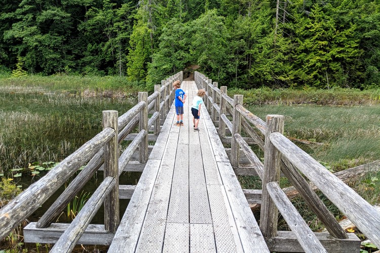
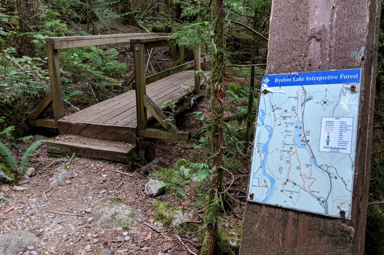
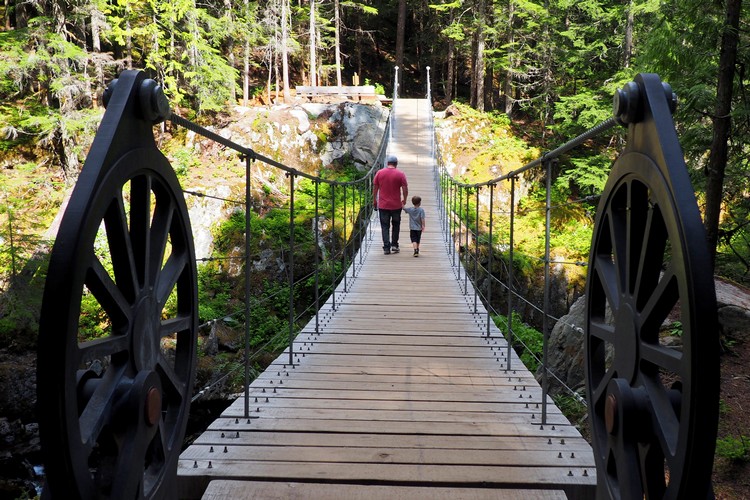
The bridge at Brohm Lake Interpretive Forest in Squamish.
Brohm Lake is a good spot to bring inflatable rafts and tubes. We noticed several groups hanging out on the rocks having picnics and sun bathing. Some people were swimming in the lake but it looked very refreshing.
It’s much quieter than nearby Alice Lake or Browning Lake, likely due to the limited parking spaces.
Trail map of Brohm Lake Interpretive Forest.
Although, it’s not much of an ‘interpretive forest’. We only noticed 4 signs on our one hour hike around the lake. The information on the signs was brief and very high level, so don’t expect to walk away educated about the forest and it’s history.
Tantalus Lookout
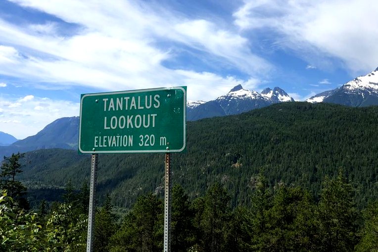
The Tantalus Lookout is one of the essential stops along the Sea to Sky Highway. This scenic roadside viewpoint offers amazing views of the Tantalus Range and its jagged rocky peaks and white glaciers.
The main Tantalus Lookout can only be accessed when traveling south, from Whistler to Squamish. You cannot turn into the main lookout when driving northbound. However, there is an alternate parking lot just opposite the main turnoff for northbound traffic.
There are green road signs on the Sea to Sky highway that say “Viewpoint ahead”. It’s best to use your GPS or have a navigator advise the driver when the turnoff is approaching. If you miss the turnoff, you can’t turnaround. You’ll need to continue driving and try again when you return.
Garibaldi Provincial Park
Garibaldi Provincial Park is a massive wilderness park located between Squamish and Whistler on the Sea to Sky Highway. This beautiful park is best visited during the summer months, when you can hike the popular Garibaldi Lake trail and/or Black Tusk trail.
The park covers an area of over 1,950 square kilometres (753 sq mi) and is home to some of British Columbia’s most impressive hiking trails. There are five entrance points located along the Sea to Sky Highway. There are also several camp sites that are first come, first served.
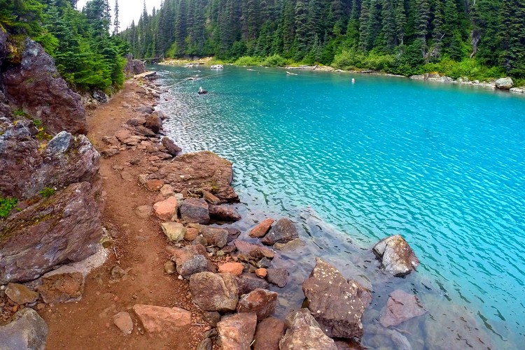
If you’re looking for a full day hike, Garibaldi Lake will do the trick. This hike is 18 km round-trip with an 800 metre elevation gain. It takes about 5 to 6 hours to complete.
Brandywine Falls Provincial Park
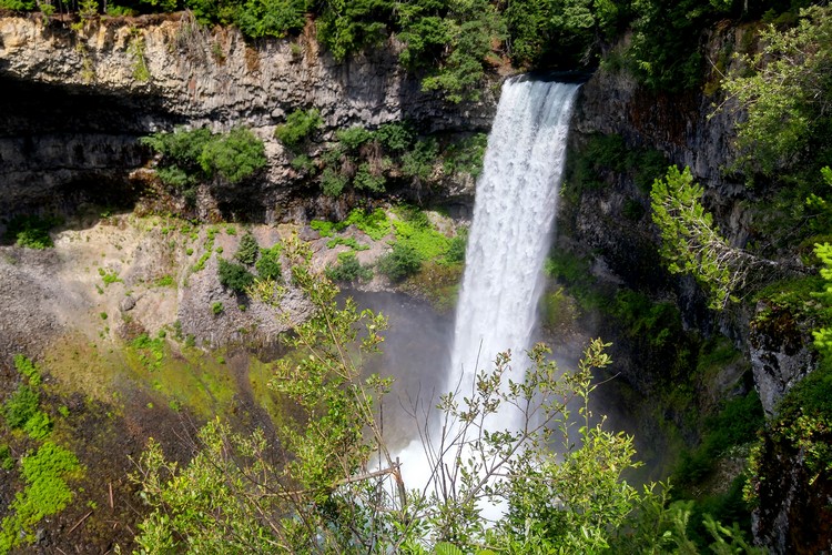
Brandywine Falls is a spectaculr 70 metre waterfall located along the Sea to Sky Highway just south of Whistler.
The waterfall is best viewed from the Brandywine Falls Viewpoint, which is an easy 15 minute walk from the parking lot on a well marked forest trail.
There are a few hiking trails inside the provincial park, including the Lava Lake Trail and sections of the Sea to Sky Trail. You can also access the iconic Whistler Bungee Bridge from the hiking trails inside Brandywine Falls Provincial Park.
View the Brandywine Falls Park Trail Map here.
Brandywine Falls is one of the most instagramable waterfalls in British Columbia. The photo above is easy to capture, however, many photographers prefer to capture the waterfalls from the bottom.
There’s an unofficial trail that leads to the base of Brandywine Falls, but you’re technically not supposed to use this trail and you could be fined if you do (you must cross a fence with sign that says “Area Closed; No Access”. That’s why there’s limited information about how to get to the base of Brandywine Falls.
To get to Brandywine Falls Provincial Park, drive the Sea to Sky highway about 15 minutes south of Whistler Village. The park offers free parking and washroom facilities.
Related – 20 Things to do in Whistler this Summer
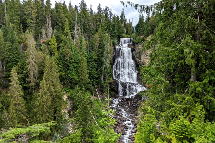
Alexander Falls
Up until a few weeks ago, we had not heard of Alexander Falls. We have driven the Sea to Sky Highway over a hundred times and we’re still finding new places – that’s one of the things we love about this part of British Columbia.
Alexander Falls drops 141 feet (43 metres) over three sections and is about 40 feet wide (12 metres). It’s not as big as nearby Brandywine Falls, which is considered to be Whistler’s most spectacular waterfall, but it’s still an impressive waterfall and worth checking out.
What’s nice about this waterfall is that the viewing platform is located directly beside the parking lot. So, if you’re tight on time or you don’t want to go for a long hike, this waterfall is a good option. No walking or hiking is required.
The best time of years to view the waterfall is late-spring or early-summer (May and June) when the snow melts from the nearby mountains. We’ve read that the waterfall freezes during the winter months because of the limited water flow and high elevation.
How to get to Alexander Falls in Whistler
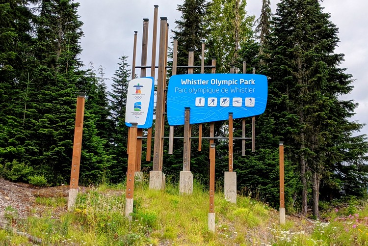
To reach Alexander Falls, drive north from Squamish until you see a road sign that says Callaghan Valley and Whistler Olympic Park. Turn left here and follow the paved road for another 10 km. It’s about a 10 minute drive. There are road signs for Alexander Falls. You will turn left down a single lane gravel road for about 50 meters until you reach the parking lot.
If you see the Whistler Olympic Park sign in the photo below, you’ve gone too far.
Whistler Olympic Park
Not to be confused with the Olympic attractions in Whistler Village, the Whistler Olympic Park is located in the Madeley Creek basin in the Callaghan Valley, about 15 minutes southwest of Whistler.
Whistler Olympic Park hosted ski jumping, cross-country skiing and biathlon for the Vancouver 2010 Olympic and Paralympic Winter Games.
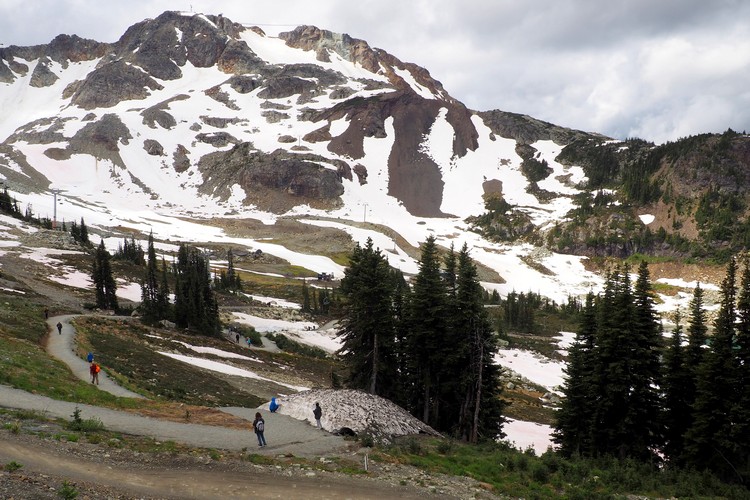
In the summer, there are three designated hiking routes with different difficulty levels are available. You can hike the Ski Jump Scramble to the top of the Olympic ski jumps. The views from the top will surely give you a new appreciation for the sport of ski jumping.
Whistler Olympic Park also has an interpretive walk that educates visitors about the history and legacy of 2010 Winter Olympics.
There is an entrance fee of $10 to enter the Whistler Olympic Park .
Biathlon Experience
Guests can also try the Biathlon Experience, a hands-on introduction to the winter sport of biathlon. This tour allows guests to shoot a 22 calibre rifle at the Olympic shooting range, the same location that was used for the 2010 Winter Olympics.
You must book this experience in advance. No previous experience is necessary. It takes about 30 minutes. You must be 12 years or older. Price is $25 per person.
Whistler
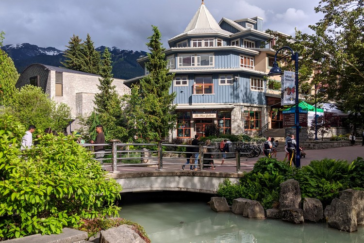
Whistler is easily one of the top tourist destinations in British Columbia.
For most people, Whistler is considered to be the end of the Sea to Sky Highway. Technically that is not true; the highway continues north to Pemberton and, some will argue, it finishes in Lillooet.
Regardless, it’s easy to understand why Whistler is the final destination for many who drive the Sea to Sky Highway. It’s one of our favourite places in British Columbia.
There are so many fun outdoor adventures in Whistler that it requires a separate Whistler blog post.
Here are just a few of the top Whistler summer activities
- Peak to Peak 360 Experience – ride the longest continuous lift system in the world!
- Whistler Downhill Mountain Bike Park
- See colourful abandoned trains at the Whistler train wreck hike
- Golf at world class golf courses surrounded by mountains
- Zipline down the longest zipline in North America
- River rafting excursions down Green River or Elaho and Squamish Rivers
- See wild bears in their natural habitat on a bear viewing tour
- Get off road on an ATV, Jeep or 4×4 buggy tour
- Take a relaxing Spa day at the Scandinave Spa
- Experience the Vallea Lumina Multimedia Night Walk
- Take a scenic flight or heli-tour over the Coast Mountains
Read more Whistler posts here.
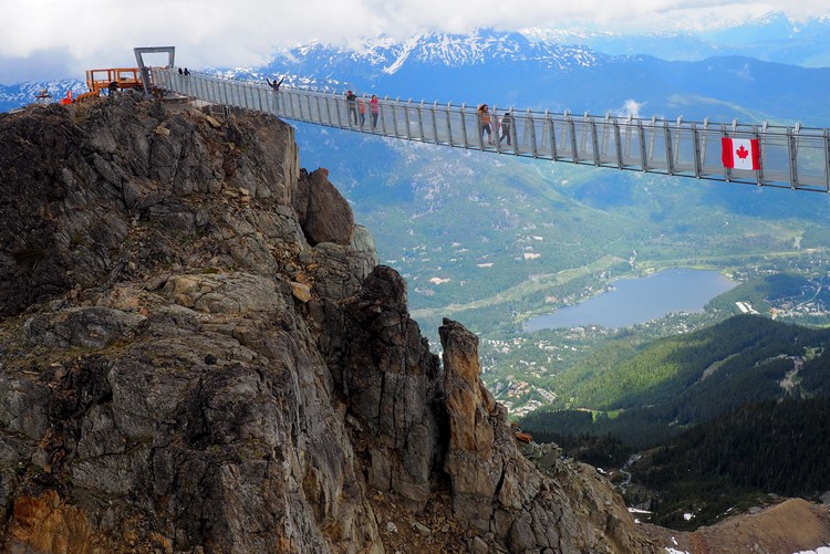
Above is the dizzying Whistler Mountain Peak Suspension Bridge.
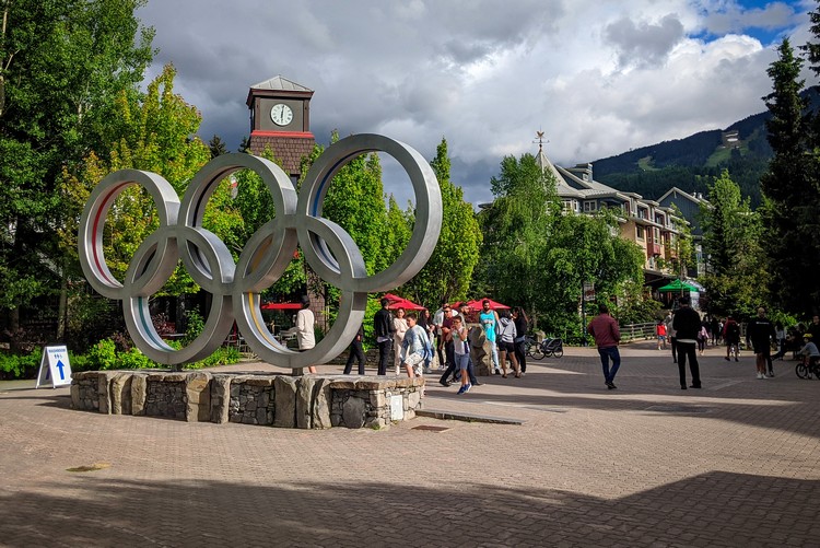
The Olympic Rings at Whistler Olympic Plaza in Whistler Village.
Pemberton Valley
Pemberton is a village municipality located 30 minutes north of Whistler in the Pemberton Valley. It offers easy access to many of the same summer and winter activities that you would find in Whistler, but without the crowds.
On your way to Pemberton, make sure you stop at Nairn Falls Provincial Park, located on the Green River. The 60 metre waterfall and park is conveniently located on the east side of the Sea to Sky. To reach the waterfall viewpoint you walk an easy 1.5 km trail along the river.
Unique Things to do in Pemberton Valley
- Jet Boating with Whistler Jet Boat – ride through channels, tight canyons, and powerful white water in a jet boat. Watch this promo video to see what it’s all about.
- Heli-Fishing with Pemberton Fish Finder – year-round angling guide service that specializes in fly fishing, helicopter fishing, trolling and ice fishing. More info here.
- Pemberton Farm Tour – a self-guided farm tour experience that helps to promote local farmers and producers. More info here.
- Golfing at Big Sky Golf Club – rated as the Best Public/Resort Course in British Columbia.
- Family bike ride on the Nairn Falls Connector – the newest section of the Sea to Sky Trail. Ride from One-Mile Lake to Nairn Falls and back, with a stop at the beach at One-Mile Lake.
- Horseback riding with Copper Cayuse Outfitters – guided horseback rides in Pemberton at an old horse ranch. You can also do full day and three day trips on its exclusive 4000 hectare tenure Birkenhead/Tenquille Lake back-country. More info here.
Related – The Perfect Road Trip from Vancouver
Joffre Lakes Provincial Park
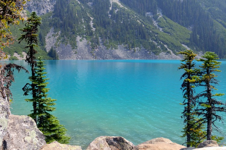
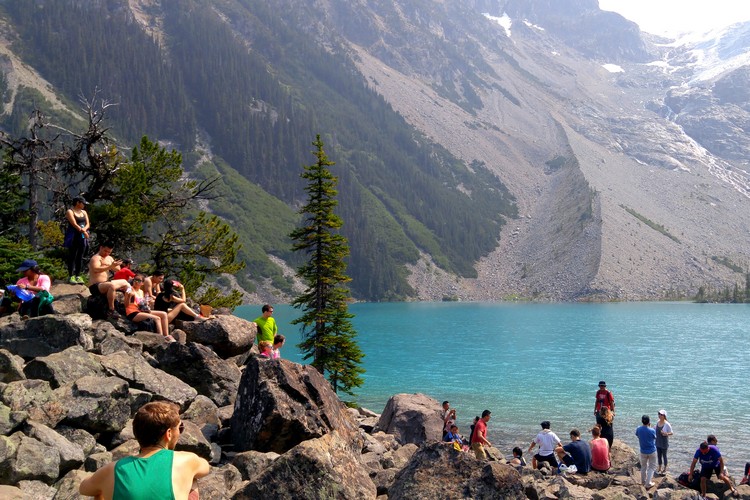
Located north of Pemberton, Joffre Lakes Provincial Park was once one of British Columbia’s best kept secrets. Social media has quickly turned this park into one of the most photographed lakes in British Columbia. Middle Joffre Lake is up there with Moraine Lake and Lake Louise as one of the instagramable lakes in Canada. See for yourself here.
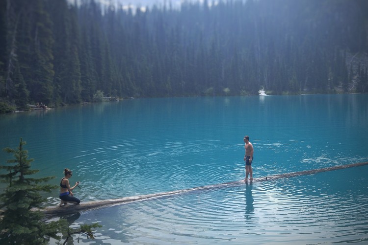
Whether you realized it or not, you’ve likely seen Joffre Lakes in your social media feed. It’s the photo where the person walks on a fallen tree log to the middle of a lake with unbelievably turquoise water.
The famous (or infamous) fallen tree at Middle Joffre Lake.
It is the location of thousands upon thousands of Instagram photos. This photo was taken when there was a forest fire nearby, which is why the scene is hazy and smoky.
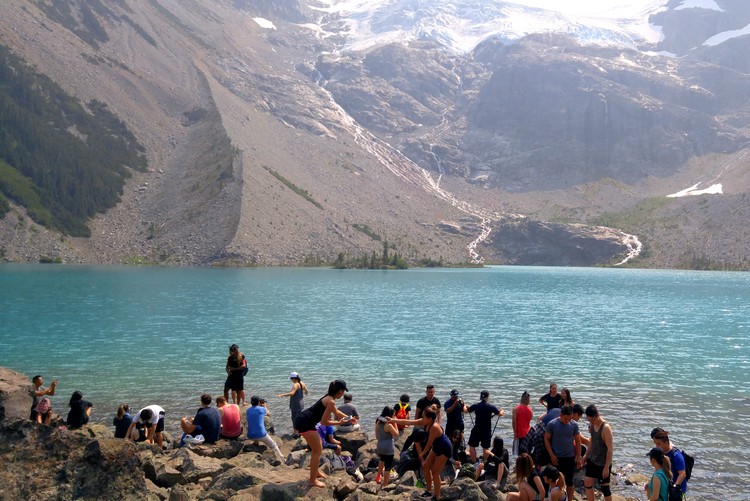
What you cannot see in this photo is the long line of people waiting to take the exact same photo.
While it’s great that so many people want to explore the beautiful parks in British Columbia (we do, too!), unfortunately too many people are now visiting Joffre Lakes. It’s having trouble dealing with the rapid increase in visitors (168% increase since 2010).
The Joffre Lakes parking lot is always full and visitors resort to parking on the side of the highway, which is not allowed and vehicles might get towed.
It’s easy to understand why Joffre Lakes Provincial Park has become so popular. The jagged mountain landscapes and vibrant lakes are insanely beautiful. But don’t make the mistake of believing Instagram and thinking you’ll have this lake to yourself. You won’t.
Hike to Upper Joffre Lake
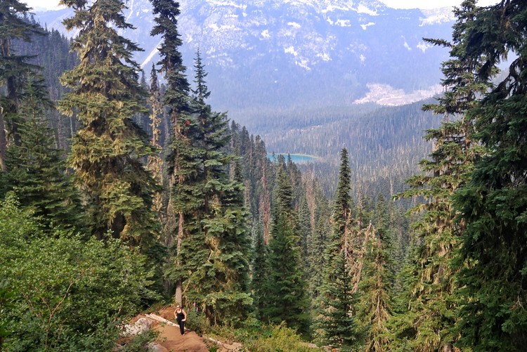
The hike to Upper Joffre Lake (pictured above and below) is 10 km round-trip with an elevation gain of 370 metres. It take about 4 hours to complete, which is relatively accessible when compared to other high elevation hikes that lead to glaciers and alpine lakes.
More info about the Joffre Lakes hike here.
Related – The Best 10 Day Road Trip from Vancouver
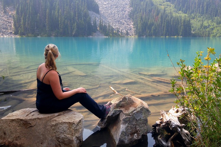
Nicole enjoying the moment at Middle Joffre Lake.
Best hikes along Sea to Sky Highway
We’ve mentioned a few different hikes in this post. Below is a list of some of the most popular hikes in the Sea to Sky Corridor. Some of these hikes can be quite strenuous, so make sure you do your research before you start your hike.
- Eagle Bluffs trail in Cypress Provincial Park
- Murrin Park Loop Trail in Murrin Provincial Park
- Petgill Lake hike near Murrin Provincial Park
- Upper Shannon Falls trail at Shannon Falls Provincial Park
- Sea to Sky Summit trail at Sea to Sky Gondola
- Stawamus Chief hikes – First Peak, Second Peak and Third Peak
- Four Lakes Trail in Alice Lake Provincial Park
- Smoke Bluffs Park loop trail in Squamish
- Elfin Lakes trail in Garibaldi Provincial Park near Squamish
- Brohm Lake Interpretive Forest just north of Squamish
- Garibaldi Lake and Panorama Ridge hikes
- Black Tusk trail in Garibaldi Provincial Park, south of Whistler
- Whistler train wreck hike, located just south of Whistler
- Whistler Blackcomb high alpine trails
- Lost Lake trials near Whistler Village
- Wedgemount Lake trail in Garibaldi Provincial Park, north of Whistler
- Joffre Lakes trail in Joffre Lakes Provincial Park near Pemberton
Check the BC Parks website for updated information.
Where to stay on the Sea to Sky Corridor
Unless you are doing a day trip from Vancouver, you will likely want to stay in Squamish, Whistler or Pemberton, depending on what you plan to do on the Sea to Sky Corridor.
We shared our favourite places to stay in Whistler in this post. Scroll to the bottom. Or, search for Whistler hotel deals here.
We have not stayed overnight in Squamish, so we cannot provide firsthand experiences. You can search for hotels in Squamish here.
Unique places to stay on the Sea to Sky Highway
Campgrounds on the Sea to Sky Highway
- Porteau Cove Provincial Park campground
- Klahanie Campground in Squamish
- Squamish Municipal Campground
- Mamquam River Campground in Squamish
- Alice Lake Campground in Squamish
- Cat Lake Recreation Site in Squamish
- Paradise Valley Campground in Squamish
- Squamish Valley Campground
- Garibaldi Lake Campground (hike in campground)
- Whistler RV Park and Campgrounds
- Riverside Camping & RV Resort in Whistler
- Cal-Cheak Recreation Site in Whistler
- Nairn Falls Campground near Pemberton
- Owl Creek Recreation Site
- Joffre Lakes Provincial Park (hike in campground)
Most campgrounds in British Columbia require reservations.
Check the BC Parks website for reservation information, campground availability and pricing.
Campground at Porteau Cove Provincial Park.
Where does the Sea to Sky Highway start and finish?
The main section of the Sea to Sky highway (also known as Highway 99) starts in West Vancouver and continues to Whistler, passing through Squamish and several communities along the way. However, the Sea to Sky Highway continues from Whistler to Lillooet, passing through the Pemberton Valley.
Is the Sea to Sky Highway Dangerous?
When Vancouver and Whistler won the bid to host the 2010 Winter Olympics, the Sea to Sky Highway received significant upgrades. Prior to these upgrades and expansion, the Sea to Sky Highway was known for its safety hazards.
It used to be a two lane highway with windy, beat-up roads and almost no barriers. Accidents used to happen frequently when bad weather conditions hit the region. In the winter, drivers can expect lots of rain or snow on the Sea to Sky Highway.
Since the upgrades, Sea to Sky Highway conditions have improved significantly. Most of the highway now has four lanes (two in each direction) and barriers that separate northbound and southbound traffic.
The Sea to Sky Highway speed limit ranges from 80 to 100 km/h (50 to 62 mph) with 60 km/h (37 mph) sections in Lions Bay, Britannia Beach and parts of Squamish.
Take your time and enjoy the spectacular views!
Sea to Sky Highway Drive Times
If traffic and weather is good, you can drive the Sea to Sky Highway from Vancouver to Whistler in 2 hours. Less if you don’t make any stops.
However, if you want to make stops on the Sea to Sky Highway, we’d recommend you plan for a full day. Obviously, this will vary depending on the stops you make and how long you spend at each stop.
Otherwise, you can visit many of these Sea to Sky Highway attractions as a day trip from Vancouver or Whistler.
Best time to drive the Sea to Sky Highway?
The best time to visit the Sea to Sky Corridor is in the summer months, between June and September. That said, you can drive the Sea to Sky year round, so there really isn’t a bad time to visit the region.
During the winter, Sea to Sky Highway road conditions can be unpredictable, especially the section between Squamish and Whistler. Drivers are advised to use extra caution and prepare for rapidly changing weather conditions.
Winter tires are required on the Sea to Sky Highway from October 1 to March 31.
Read more posts from British Columbia:
We hope you enjoyed this list of things to do along the Sea to Sky Highway.
If you have any questions, please leave a comment below. Also, if you have any tips or advice, please leave a comment. Our readers thank you!
